
Trending now
The central government is going to replicate Maharashtra’s drone survey across the country for property validation.
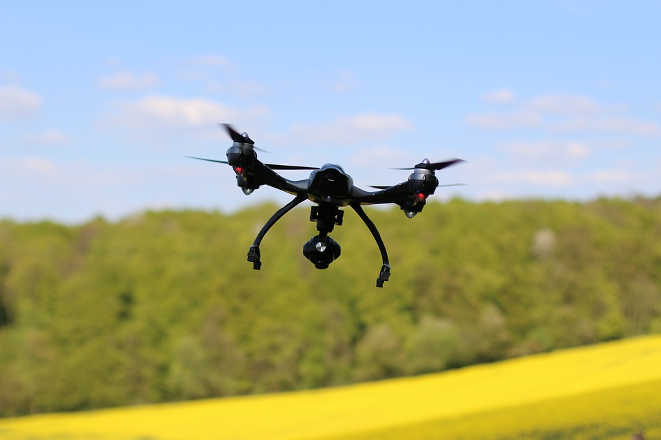
The central government is seeking to take a leaf out of the drone survey carried out by the state government to map housing in rural areas and replicate it across the country.
Last year, the first survey of state property using Unmanned Aerial Vehicles (UAVs) was conducted at Sonori village in Pune District to map spatial details.
The aim was to offer property titles in about 40,000 villages to residential and other properties and to enable residents to obtain better liquidity on those assets.
“We began the survey in Pune and then planned to replicate it all over the state. We were going to establish teams to do the same, but couldn’t do it because of the COVID-19 pandemic. The work will begin after the monsoon,” Settlement Commissioner S Chockolingam said.
He said the program would be carried out under the Panchayati raj ministry’s SVAMITVA scheme to provide an integrated real estate validation solution for rural India. Inhabitant land demarcation in rural areas will be achieved using drone surveying technologies with joint initiatives from the Panchayati raj ministry, state Panchayati raj department, state revenue department, and the Survey of India (SOI).
The SOI has developed basic operating procedures to collect extremely high-resolution aerial images and to use drones to produce extremely wide scale maps at a scale of 1,500/1,000. The mapping of rural households in collaboration with different state governments viz Maharashtra, Haryana, Karnataka, Madhya Pradesh etc. had been conducted by SOI over the past one-two years mainly for use as revenue maps to grant ownership rights.
Based on these maps or info, the government of Maharashtra and the Haryana government provided property cards to the citizens in Sonari village and SIRSI village. The high-resolution and precise image-based maps also enabled the creation of the most reliable database of real estate holdings in such areas with no records of legacy revenue, officials said.
The pilot phase will extend to around one lakh villages comprising six states (Haryana, Karnataka, Madhya Pradesh, Maharashtra, Uttar Pradesh and Uttarakhand). At the time of signing the MoU with Survey of India, the respective state governments will finalize the list of villages.
Related Post


One thought on “The central government is going to replicate Maharashtra’s drone survey across the country for property validation.”
Leave a Reply


Our Esteem Clients:


Channel Partner Associations:


Our Partners:


Our Supporters:


though i am not bjp. I like this historical mile stone work. proud of beein an indian